LANDFORMS
Some of Swedens landforms are, The Scandinavian Mountains, Gotland and Oland (a city of islands), Varern and Vattern, and Kebnekaise (Swedens highest point)

Scandinavian Mountains

Kebnekaise (Swedens highest point)
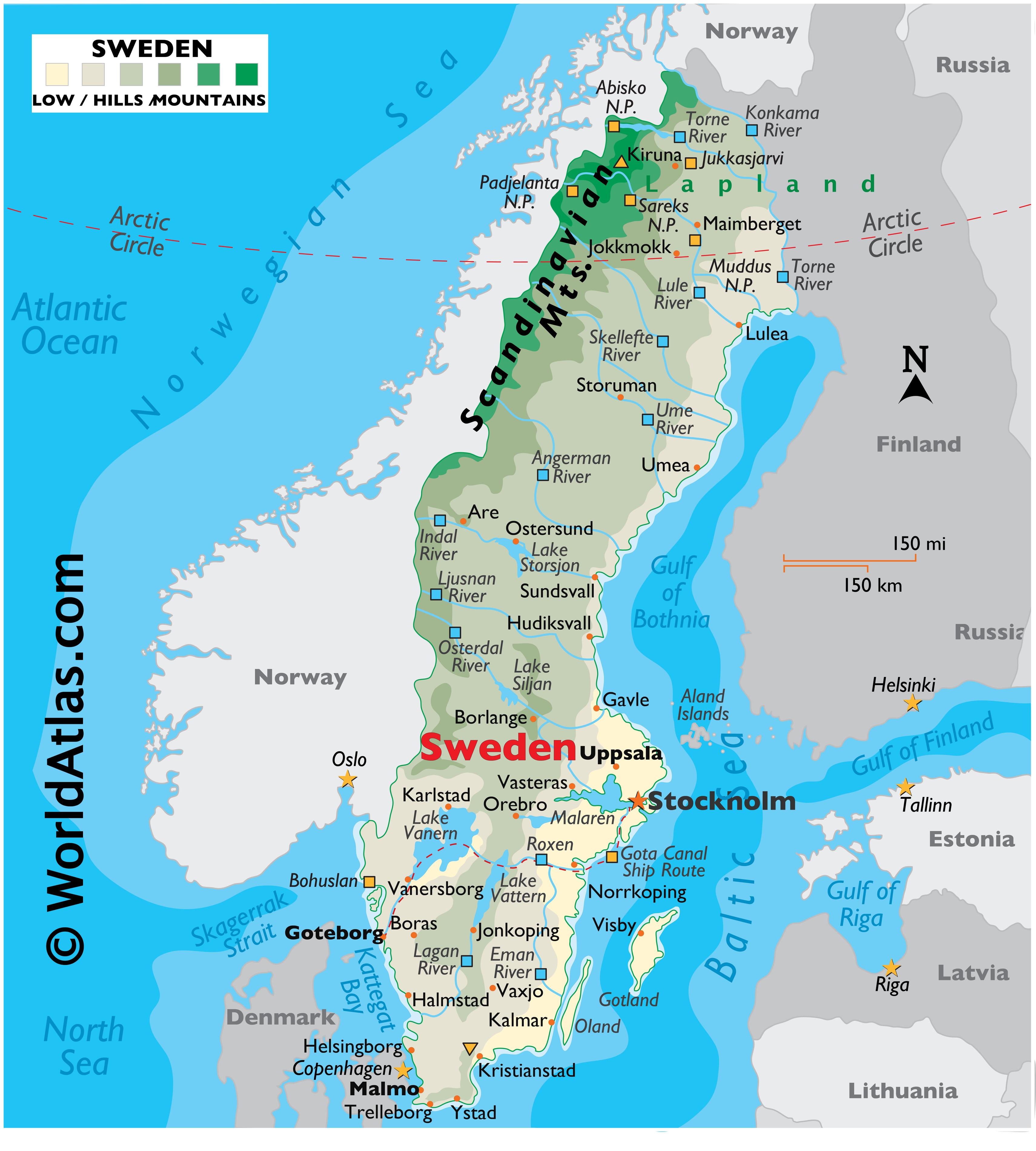
In the north (above the Arctic Circle) Sweden is rugged with snow-covered mountains and thick forests, while central Sweden is mostly covered with mountains in the west that have hills and ridges, dozens and dozens of rivers and an estimated 101,000 lakes. In the south, large lakes (some linked by canals) and widely cultivated plains stretch across the land.
Sweden's border with Norway is covered by the Scandinavian Mountains, or in Swedish, the Kolen (or Kjolen) Mountains. Sweden's highest point, Kebnekaise, stands at about 7,000 ft.
Sweden's coastal areas include several small islands and reefs, especially in the east and southwest. Directly south of Stockholm (a city of islands) are Gotland and Oland, Sweden's largest islands. White sandy beaches are common along the southern coastline.
Significant lakes include Siljan, Storsjom, Varern and Vattern.
Sweden's largest rivers include the Angerman, Eman, Indal, Lagan, Ljusnan, Lule, Osterdal, Skellefte, Storuman, Torne and Ume.
CLIMATE
The average climate in Sweden is, it is usually cold and it gets no higher than 70 in the summer and -4 in the winter. It has all the seasons and the temperature doesn’t vary very often.