Glaciers
The largest reservoir of fresh water on Earth is:
Glaciers!
What is a glacier?
What types are there?
What are the features of glaciers?
How do they alter the landscape?
These are the questions we will hopefully be able to answer as we study the largest reservoir of fresh water on Earth.
Essentially a glacier is a mass of compressed snow and ice called firn. Snow sinters into firn (think compressing a snowball). These occur anywhere that there is snow and temperatures that rarely get above freezing.
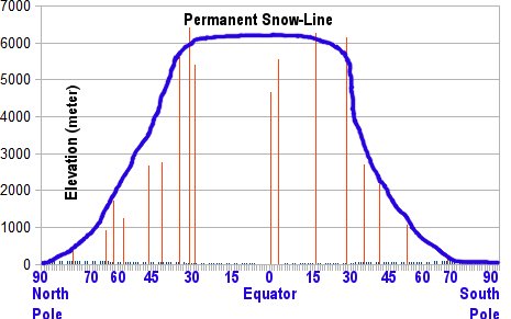
Here on Earth the two places that fit those criteria are high altitudes and high latitudes (mountain tops and near the poles).
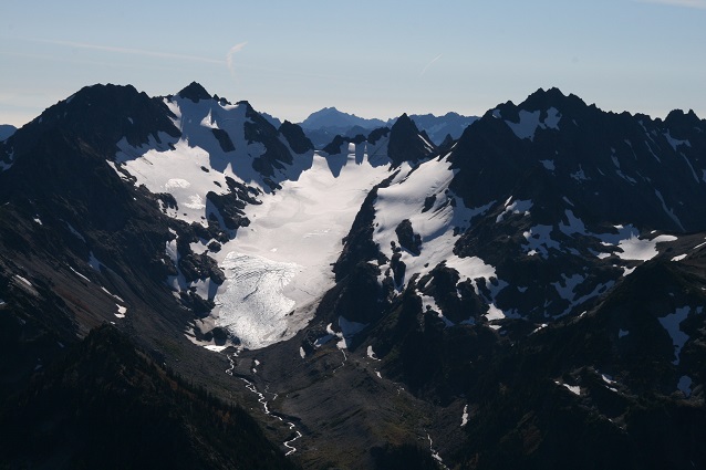
Glaciers in the high altitudes are called alpine glaciers.

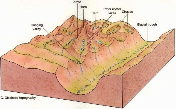
The glaciers alter the landscape in destinctive ways. We have named many of those features:

Some of those features were:
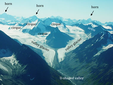
Cirques are circular birthing places of glaciers.
Crevasses are where glaciers go over a drop (sort of an glacier waterfall). They are deep breaks in the ice and very dangerous.
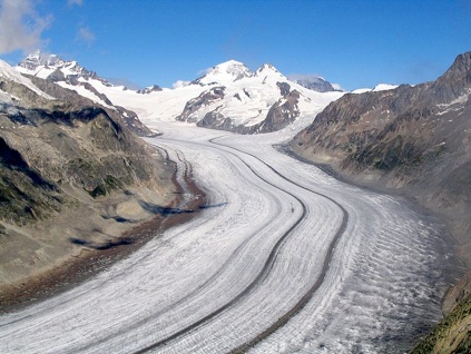
Moraines are piles of debris pushed by the glaciers.
There are terminal moraines at the end of the glaciers reach.
There are lateral moraines at the edge of the glacier (from the mountains)
There are medial moraines where two glaciers come together and their lateral moraines combine.
Features on the glacier itself include:

Crevasses

Cirques
Medial and terminal moraine
Alpine glaciers are meters thick, found in high elevations, and travel downhill.
They can be found anywhere in the world if you go high enough.
So you can find alpine glaciers at the equator if you have a tall enough mountain. At the poles, you needn't have any elevation.
Effects of an alpine glacier include:
Horns are pointy mountain tips where three or more circques come together.
Aretes are ridges that glaciers carved out on either side (U-shaped on both sides)
Tarns are lakes in the hollow left by a cirque.
Cols are low spots in aretes.
U-shaped valleys are made by the moving glacier and creates fjords.
Arete:

Horn:

Tarn:

U-shaped valley:

Fjords:
They move!
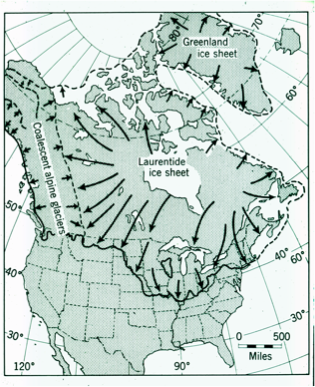
Glaciers found at the poles can be huge and are called continental glaciers.
Continental glaciers:

These are kilometers thick, found at high latitudes, and travel towards the equator.
Continental glaciers flatten everything. They leave behind interesting features:
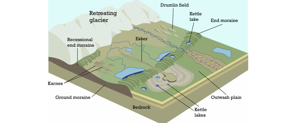


Some of those features are:
Esker

U-shaped valley (see above)
Drumlin
Kettle pond
Kame

Filled in E-W rivers
Deeply dug N-S rivers
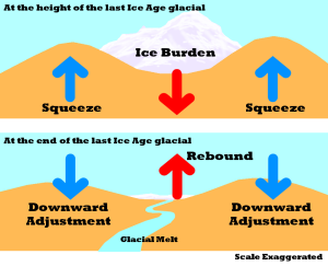
Rebound
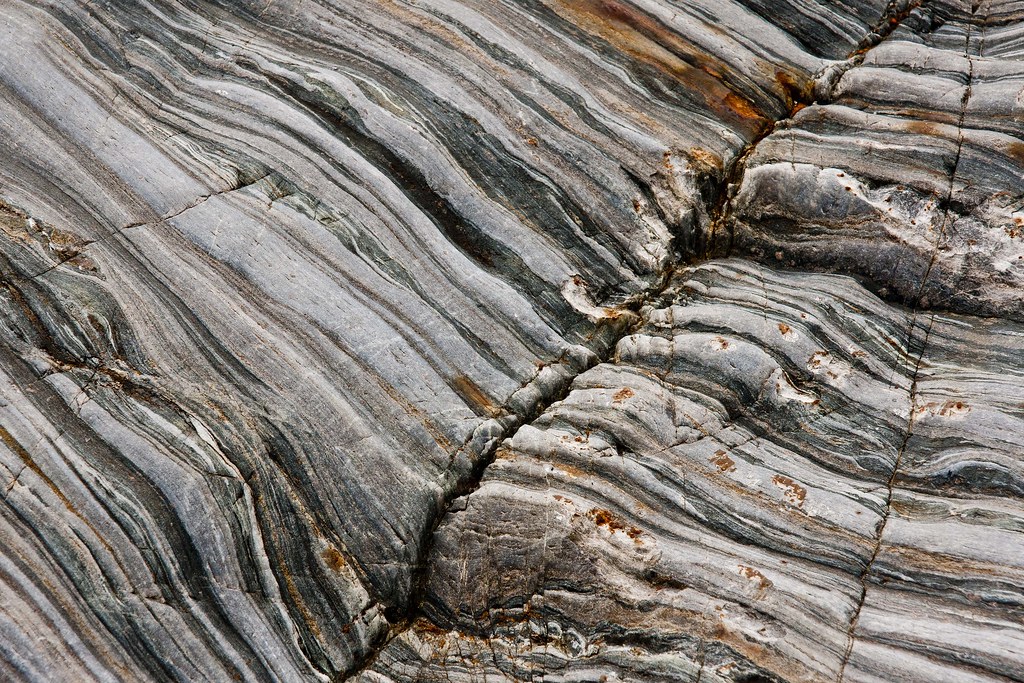
Striations in bedrock
erratics
Moraines:
![]()
What those are (in words):
Esker - a winding river of glacial debris deposited by glacial meltwater
Drumlin - a squashed mountain with a steep polar face and a gradual equatorial side
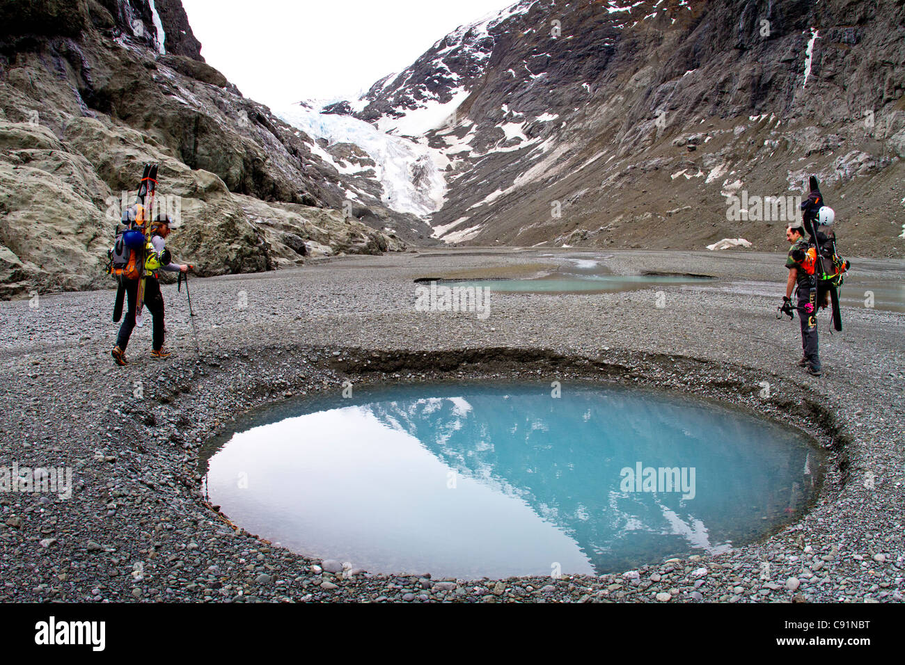
Kettle pond - a lake caused by a chick of ice falling into the glacial debris and melting
Kame - a cone shaped pile of glacial debris caused by the deposition of a medial moraine
Terminal moraine - the pile of glacial debris at the end of the glaciers extent
Erratics - a rock carried by a glacier to a distant place and then deposited
Rebound - the lithosphere pushing back up from years of being squished by all that ice
Striated bedrock - N-S grooves in the bedrock due to the glacier scouring all the soil away
N-S deep rivers and U shaped valleys -
E-S new rivers with waterfalls -
Glacial till & glacial flour & glacial milk
Glaciation and ice ages are important to understand.
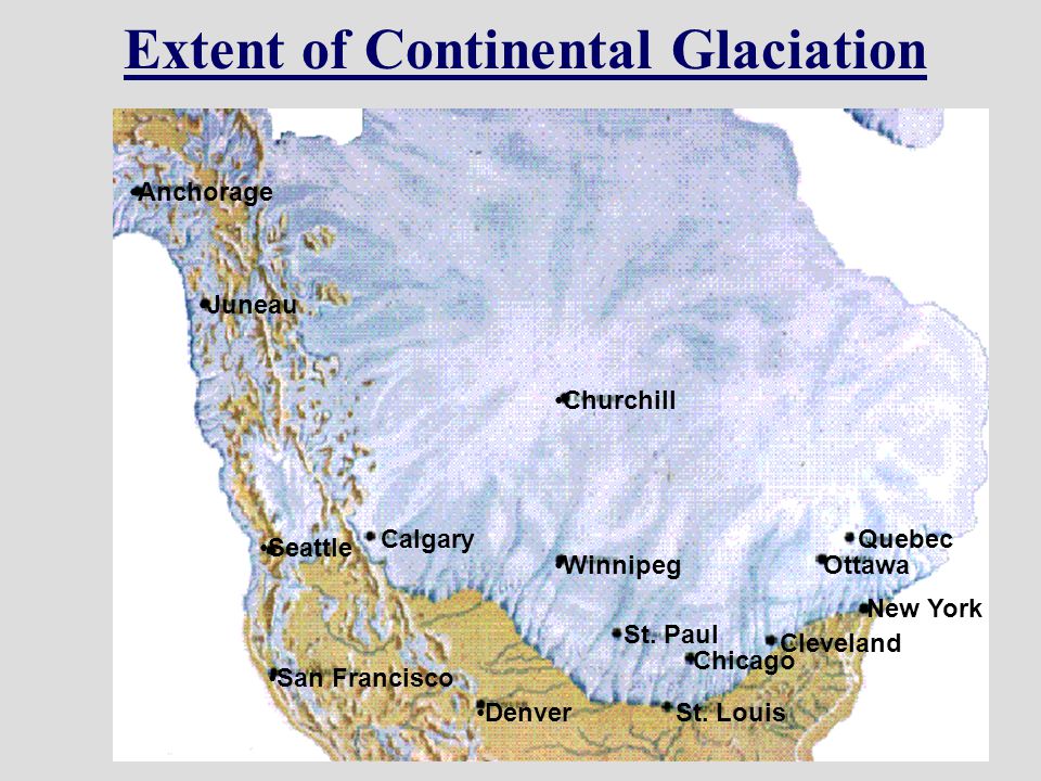
The continental glacier that once covered us:
The temperature:
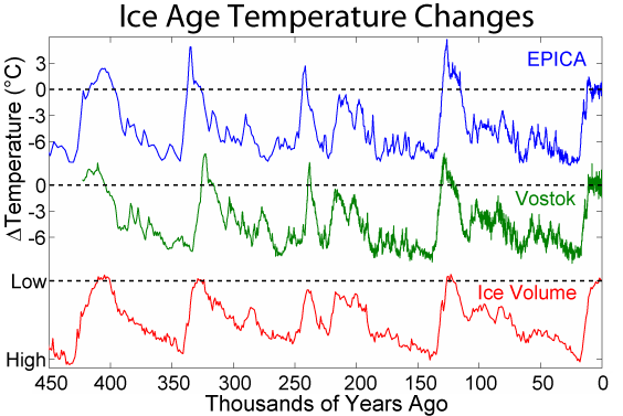
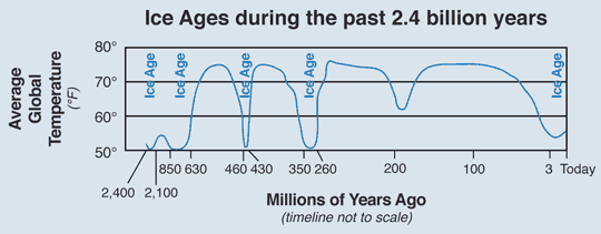
What caused it?:
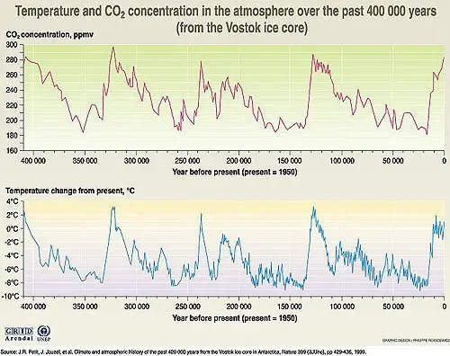
So scientist the world around have looked at data from lots of sources and agree that the Earth's temperature fluctuates periodically as does CO2. The CO2 levels line up eerily with the temperature and slightly proceeds the temperature change.
So, do you now know what glaciers are
The two types and how they are different
The features of them and signs that they were covering an area
And even a little about ice ages?